Human-environment intersections require investigation through research that is transdisciplinary and creative. While this has always been the case, our current context of anthropogenic climate change makes this even more imperative if we are to fully understand how the human present and future intersects with our past. The people who lived in coastal NW Patagonia experienced repeated explosive volcanic eruptions as well as a remarkable 60 m of sea level rise. My current research project, in its larger sense, looks at the past experience of dramatic climate changes and queries how they can inform our current perceptions of the changes we ourselves face.
I am the Principal Investigator (PI) of a project that is funded by National Geographic (NGS-185C-18) to create the core unit of an ongoing, transdisciplinary team that contributes to the conservation of cultural heritage and geoheritage in Chaiten, northwestern Patagonia, as the town continues to recover from a volcanic eruption in 2008. Our team began assembling on March 22, 2018, to begin fieldwork.
In 2008, Chaitén Volcano in northwest Patagonia erupted unexpectedly and prompted the largest evacuation in Chile's history. Recovery from this eruption event is ongoing as residents resettle the town. ProCultura, a Chilean organization dedicated to promoting natural and cultural heritage, is preserving a row of houses inundated and partially buried by re-mobilized ash and flooding caused by the 2008 eruption. These houses and the conserved volcanic materials represent geoheritage (geological heritage) that can bolster sustainable tourism and provide local economic benefit. ProCultura encouraged our team's current fieldwork as a means to collect archaeological data that can encourage the conservation of a cave complex, Vilcún, which contains rock art (47 designs painted in red iron oxide; 9 excised designs), shell middens, ceramic and lithic material, faunal remains, and the remains of a child. Combined volcanic-archaeological sites are important draws for tourism globally, hence the linkage of the prehistoric caves and contemporary sites of volcanic disaster does have distinct possible financial benefits for the local community. Both the Vilcún caves and the conserved contemporary houses are already the target of vandalism, however, and without conservation measures they will be progressively compromised and disturbed.
The similarity of Vilcún rock art designs interpreted as ‘vulvas’ to similar designs in the coastal area of Valdivia and the Mapuche indigenous culture area to the north also suggests ties to the larger region. Insufficient data exist currently, however, to determine how the Vilcún site intersects temporally with other sites in the region. A single radiocarbon date of roughly 800 BP was obtained in 2012 by two of our team members in the only archaeological work conducted at the site. This date is relatively recent in comparison to the consensus that humans have occupied the south-central Andes for at least the past 15,000-18,000 years. Connection of the prehistoric Chaitén area to the larger region is indicated through the presence of the distinctive, translucent grey obsidian from Chaitén throughout the western archipelago. The Chaiten landscape, through its volcanic resources, has been utilized for a far deeper time period than the single radiocarbon date analyzed to date indicates.
While the most recent eruption of Chaitén Volcano represents an important contemporary example of how eruptive activity can alter landscape and coastal use, volcanism is implicated in important transformations in the way people used and occupied the Patagonian landscape since at least the early Holocene. The work by one of our team members establishes a chronology of roughly 18,000 years of explosive eruptions in the Chaitén area. In this project we seek to combine these new volcanological data with improved archaeological data. With these combined sources of data we can potentially discern an older chronology for this site using tephrochronology and also begin to form a better idea of how volcanic events were perceived by prehistoric people. Images and imagination are an important component of this scientific goal, however, and we are incorporating innovative photography, videography, and acoustic capture into our project.
Many residents of Chaitén who returned after the 2008 eruption lacked electricity or running water until 2012. Half the town still lacks these basic services in 2017. This project, while research and conservation motivated, is also explicitly invited by the municipality of Chaitén to aid them in developing sustainable economic opportunities through tourism.
[photos below all by K. Holmberg unless noted]

Our fieldwork combines archaeology, volcanology, art, and an interest in the role of creativity and the past in contemporary and future contexts

Vilcun
as seen from the sea, which is how prehistoric visitors would have reached the Chaiten area
[photo credit: team member Brent Alloway]

Vilcun
as seen from Santa Barbara beach, where the government first considered resettling Chaiten's residents once the volcanic eruption ended (they instead opted to resettle the town's original location)
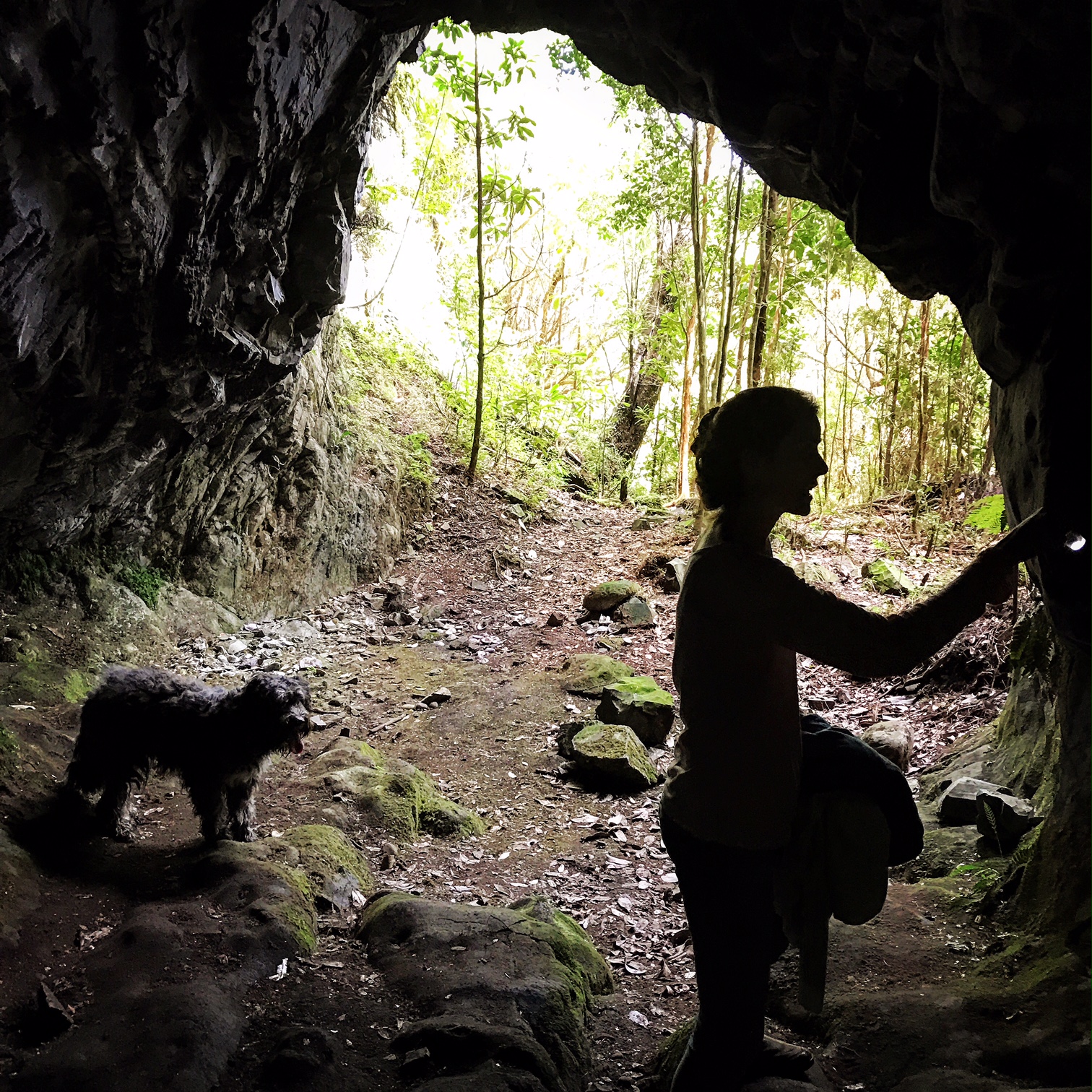
The entry to one of the caves, as seen from the inside

an example of incised rock art within the caves
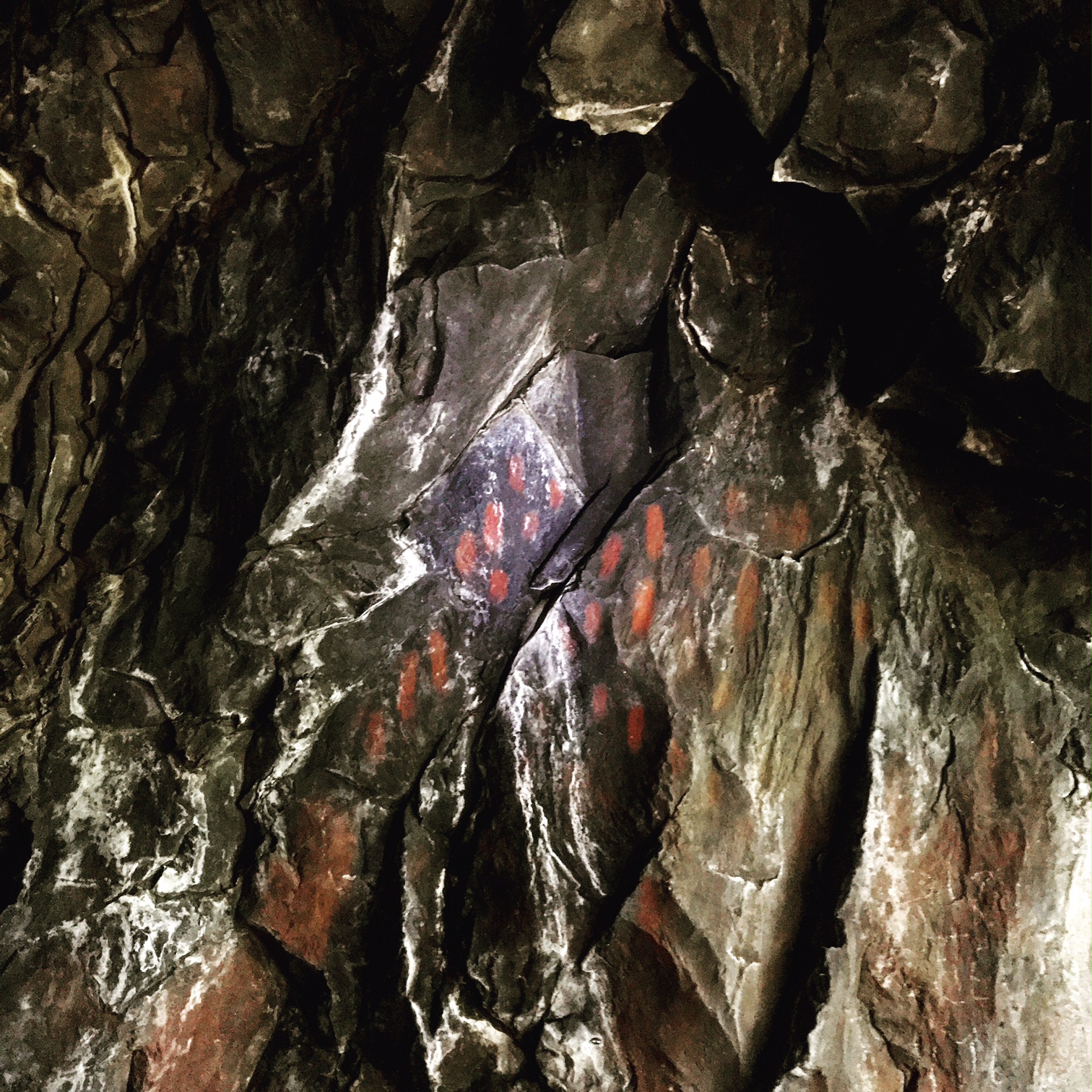
an example of painted rock art within the caves

Chaiten
The town of Chaiten was evacuated when the volcano by the same name began erupting unexpectedly in 2008

a house buried within volcanic flows

a house, now preserved as a reminder of the eruption's impacts, filled with lahar flow